To spend your life living in fear, never exploring your dreams, is cruel.

Saturday, September 11, 2010

The Chocolate Mill


A group ride for me today, with a run up to the Chocolate Mill just north of Daylesford. The chocolate mill is a shop that makes its own chocolate on site, and as a result it is so much nicer than the horrible chocolate you typically get in Australia. As a motorbiking destination rides to the mill usually go well since it's an enjoyable ride with no particularly dangerous roads. This one was no exception.

The basic route took us to Woodend via Whittlesea, Wallan and some roads around Mt Macedon. Then to the Chocolate Mill, stopping off to see Trentham Falls (pictured), with an unusually high volume of water given the recent rains and flooding in the region. Then back to Melbourne on the Western Freeway, but not before enjoying part of the well-known biking route between Kyneton and Mymiong.

Something I must focus on is not looking at unusual hazards. A bike goes where you look, so looking at hazards is a bad thing. In the first leg of the ride another rider ran wide ahead of me and as you can see from the video I left it unnecessarily late to countersteer around him. The video was taken from a new helmet mounted camera. Click here for some edited footage of the ride.


Riding Distance: 360 kms

Sunday, August 8, 2010

The Red Chapel


I watched my last film at MIFF (Melbourne International Film Festival) on Thursday: The Red Chapel. It's a documentary about North Korea - the Danish director and two Danish comedians born in South Korea (presumably without South Korean passports) visit the country on the pretext of doing a comedic theatrical performance. The film won Best Foreign Documentary at Sundance, and there was a full house of about 300 (mainly Australian) people to see it.

The monuments and places visited didn't interest me so much; I have been to North Korea and everyone who goes there, whether tourist, journalist or diplomat, sees the same things. What was great about the film was that the younger comedian Jacob showed so perfectly the contrast of emotion in any North Korean visit. Your North Korean hosts are so unbelievably kind and generous to you, it is hard to remind yourself of what actually goes on there, and even harder to bring it up in conversation.

There was a great moment at the end where the director gets Jacob, who has cerebral palsy, to ask his female host why he hasn't seen any other disabled people in Pyongyang. But before she thinks of an answer, Jacob rescues her by saying that he should meet some on his 'next visit'. I know exactly that feeling. It was very difficult for me to ask the hard questions, particularly when you are being filmed all the time (as all tourists are) and when there is a more senior onlooker in attendance. There is no danger to you, but the consequences for your host is one of the many unknowns.

There was nothing of interest to me at MIFF on its final weekend, so instead I took a cycle ride from the hills of Belgrave, on the Eastern end of the metropolitan train line, South West to the beach at Carrum. The first section of the ride links Belgrave to the pretty Lysterfield Lake area via some rather muddy tracks through Birds Land Reserve. It was heavier going than I expected, and at one brief point I had to get off the bike a walk it through the mud. A commuting bike was not the ideal piece of equipment for this section of the ride. Rough tracks comprised the remainder of the route from Monbulk Retarding Basin to Lysterfield Lake. Around Lysterfield Lake is the State Mountain Bike Course; a large network of mountain bike trails that were built a few years ago for the 2006 Commonwealth Games. The local cafe doubles as a bike shop where you can rent or buy mountain bikes, some with price tags of over 6,000 AUD.

It's a faster run from now onwards, cycling through some country roads and linking up with the asphalt bicycle track alongside the Monash Freeway. On this section, just South of Lysterfield Lake is Yun Yang Temple: a large Chinese temple complex (pictured below) which was well worth a look around. The residential roads of Wattle Drive and Box Street allow you to link up with the Dandenong Creek Trail and from there is the direct run, mainly on wide bicycle tracks, to Carrum. The Dandenong to Carrum run is a well known route for Melbourne cyclists; a good fast route away from traffic, and a nice energetic way to end a ride. After a quick stroll on the beach, a coffee was the order of the day before catching the train home.


Cycling Distance: 48 kms

Thursday, August 5, 2010

A Weighty Issue


So I've registered for the Melbourne half marathon, more as an incentive to get back into running than for anything else. I'm pretty slow but have run three marathons (Thailand Temple Run, Bangkok, Edinburgh) and a few half marathons (Sydney, Melbourne, Singapore), though that was some time ago. I've got a couple of months to train so we'll have to see how it goes.

I'm fairly heavy now, at 82kg, and want to lose about 8kg for the run. Losing weight is a simple matter of mathematics. If you USE more calories (a unit of energy) than you CONSUME, you will lose weight, and you can even calculate how much.

USE: Even if you do absolutely nothing all day, you will use about 1 kcal per hour per kilogram of your weight. For me that's about 80 kcal per hour, or about 2000 kcal per day. For running or cycling I use an additional 700 kcal per hour, and for walking it is about 300 kcal. So I'll use about 2000-3500 kcal, depending on my level of activity, which I hope to keep at 3000 or more.

CONSUME: Calories are consumed either through fats (9 kcal per gram), carbohydrate (4 kcal per gram) or protein (4 kcal per gram). There are lots of websites that allow you to calculate your calorie intake. Cereal for breakfast, a nice focaccia for lunch and spag bol in the evening, with no snacking and sticking mainly to drinking water and tea, and I'm at a minimum of about 1650.

Which gives me 3000 - 1650 = 1350 as my biggest deficit. As there are 9 calories in 1 gram of fat, I should be losing 0.15kg a day, which is about 1kg a week, or 8kg in eight weeks. If I can keep it up, that is.

Sunday, July 25, 2010

The 30th Icicle Ride


On Saturday I went to see one of the few films I was really interested in watching at MIFF (Melbourne International Film Festival), called 'The City of Life and Death'. It's a film about the Nanjing (Nanking) massacre; it was a big regret of mine that when I was in Nanjing a couple of years ago the museum dedicated to the massacre was closed for renovations. The film was a huge critical and commercial success in China, and the organizers correctly predicted a big turnout, putting it in the largest capacity screen available. It's great that so many people in Melbourne turned up to watch a subtitled film. As with Speilburg's 'Shindler's List' and Haneke's 'The White Ribbon', it was shot in black and white. It didn't disappoint, containing some of the most startling scenes I've ever seen on film. There wasn't much character development, but it didn't need it, instead going for a more overarching view in order to capture the unimaginable scale of events.

Normally I would have returned back home to sleep, but instead I turned up at midnight at the petrol station near the Calder raceway, meeting 150 or so other bikes for the icicle ride. This is a group ride run overnight in the middle of winter which is well-known in Victoria and has been running annually for 30 years. The ride is run over three legs of about 120 kilometers each, finishing this year in Healsville at about 6 or 7 in the morning. I wouldn't call it a fun ride but it was certainly challenging, with temperatures dropping to zero in some places. Getting my commemorative badge upon finishing brought a sense of achievement: I can now say that I have completed an icicle ride. There was a lot of wildlife about, with two riders colliding with kangaroos and one other with a wombat. It emphasized to me one of the key dangers of riding at night in Australia.

Doing the icicle ride got me looking into issues concerning wind chill when riding. The National Weather Service in the USA use an equation to model the effective (i.e. wind chill included) temperature based on the air temperature and the wind speed. I've plotted it below using degrees Celsius for the temperatures and kilometers per hour for the speed. The equation is only valid for wind speeds of 10 kph and above, and for air temperatures below ten degrees.

The three lines represent different air temperatures: 5 degrees (sold line), 2.5 degrees (dashed line) and 0 degrees (dotted line). At these sort of temperatures a good rule of thumb is that the wind chill factor when riding is about ten degrees. The non-linearity in the curves is to be expected. Perhaps of more interest is the fact that differences in the air temperature become larger once the wind is taken into account. No wonder I was so cold.


Technical Note: The equation plotted is W = 13.13 + 0.6215T - 11.36V + 0.3962TV where T is air temperature (degrees Celsius) and where V is speed (in kilometers per hour) to the power of 0.16.

Riding Distance: 405 kms

Monday, July 19, 2010

Day 4/4: Around The Hume


I've learned much about my tolerance for cold on this trip. With my current full warm gear (non-electric) set-up, and riding at 100 km/h, anything over ten degrees is pleasant. Between five and ten is no problem at all for long distance riding. Between two and five is okay, but not hugely comfortable, with tingling hands and feet that necessitates hugging the engine every so often. Two or below and I'm staying in bed.

And perhaps tackling sixty kilometers of dirt solo, in the middle of nowhere, may be a bit too adventurous for a dirt novice. But as always, the experience has been great. I set off back to Melbourne from Yass (appropriately enough) straight down the Hume, stopping off to see a dog on a tinderbox (don't ask me) and the submarine display at Holbrook, one of only three towns not currently bypassed. And that will be the last overnight journey for my rear tyre; I gave it a good send-off.

Riding Distance: 610 kms
Total Distance: 345 + 285 + 290 + 610 = 1530 kms

Sunday, July 18, 2010

Day 3/4: Around The Hume


I crashed today. It was the first time my poor bike has been on its side for about 10 months. But it wasn't all bad. Firstly, I caught it on video. Secondly, it was on fairly wet dirt, and if you are going to crash that is the best place to do it.

Another cold morning and I was off to Corryong for a morning pick-me-up and some fuel, with the intention of taking the back-roads to Tumut via Towong, Greg Greg, Tooma and the wonderfully named Tumbarumba. Condensation from the mist was building on my visor and turning into frost. The petrol station attendant said that she'd driven up that way the day before, and gave me dire warnings about mist, kangaroos and ice in the shadows cast by the trees. It turned out not to be quite so dangerous today though, and it was a superb route to ride. The scenic lookouts, looking down onto cloud cover over the valley, were simply breathtaking.

At Tumut I stopped in at the modern tourist information center in the old butter factory and took the road to Wee Jasper, which contains two stretches of dirt, both of which are about 30kms long. Literally seconds away from the end of the first stretch the bike and I went down (see video below). I'm not sure why, and I didn't have the awareness to examine what I had just ridden through. Most of the road was dry, but this section at the bottom of a valley was damp. The video shows a patch of ground darker than the rest, but perhaps I am just looking for excuses.


No real damage to me or the bike, other than both of us being very muddy. I picked the bike up and got it going again by fully opening the throttle before cranking the engine. I tackled the second section of dirt and then rode from Wee Jasper to Yass underneath a brilliant red sunset. By the time I connected with the Hume again at Yass it was pitch black, but fortunately I finished the twisties before total darkness fell. I didn't travel many kilometers today, but those kilometers were perhaps the hardest I have ever ridden on a bike. It was an awesome day.

Riding Distance: 290 kms

Saturday, July 17, 2010

Day 2/4: Around The Hume


It was an incredibly cold morning in Wangaratta; my new digital temperature gauge was reading zero degrees, and its ice warning was flashing away at me. So I left it until 10am by which time it had risen to a whole three degrees. Then bike problems, similar to those observed in another cold morning in Mt Gambier, meant I was having coffee instead of riding the bike. It cheered me up though, as I decided the problem was with the choke and therefore minor, and by the time I had my coffee the temperature had risen another few degrees.

All this meant that I didn't get my bike started until 11am, and I had decided to spend a more relaxing day drinking coffee and exploring. I felt that the bike needed a long straight ride to get itself going, so I took the C374 to Yarrawonga on the state border. I'm glad I did, because Yarrawonga-Malwala is a lovely town, and I picked a great spot overlooking Lake Mulwala near the tourist information building for my second coffee of the day. By now the sun was out; I could have stayed there all day, but it was time to reluctantly move on.

I headed East on the Murray Valley Highway (B400), through Rutherglen, connecting with the Hume again at Wodonga, where I followed the signs to the army museum. The army museum at Wodonga appears to have had a lot more money spent on it than the one at Puckapunyal. All the exhibits are well presented and have been restored to their former glory. It even had a few motorbikes, including a Suzuki GS450 (pictured). It was disappointing that on a Saturday afternoon I appeared to be the only person there.

Further East I got off the Murray Valley Highway at Bonegilla, heading North on the C541, crossing the bridge and taking a superb detour to Bethanga (22 kms return). Although it was getting late I had heard that this was a great road, and I had heard correctly. Looking up at the guard rail on the road running up the hill you are about to climb is awe inspiring. After chatting with some locals at a scenic lookout (pictured) about how I was crazy to ride when it was so cold (my gloved hands were clutching the warmth of the engine), I returned down the hill and continued East.

The C542/6 is a great motorbiking road running along the Murray River; it was difficult not to get distracted by the eerie sight of the river and the numerous leaf-less trees within it, all shrouded in mist. It looked like a scene from a horror movie. I planned to get to Tintaldra or even Corryong but darkness fell so I stayed the night as the only resident in the welcoming one-pub town of Walwa.

Riding Distance: 285 kms

Friday, July 16, 2010

Day 1/4: Around The Hume


The Hume highway, linking Melbourne and Sydney, is one of the most boring roads on the planet. But there are some interesting things around it and I'm going to explore them on this trip.

I've been to three military bases before: one in Bangkok to do some target shooting and one each side of the Korean demilitarized zone. As I turned off the Hume at Seymour I was about to visit my forth. Puckapunyal is a huge military base containing an army museum which is known for its collection of tanks. If it was in Melbourne it would get a good number of civilian visitors. Unfortunately it doesn't because, well, its in the middle of a huge military base.

Getting in the base was no problem; after being given a visitor pass at the security check I was free to ride the bike inside the base to the museum, which even had a 'motorcycles only' parking area. The collection of tanks was impressive in size, much larger than even the army museum in London. It could do with more investment though for restoration of both the tanks and the faded signage. They also had a memorial for soldiers who had died in training. Fresh flowers were placed for the latest casualty, Private David Smith who died at Puckapunyal this time last year.

In the afternoon I tackled three rides listed in my motorcycling atlas. The first was the old Hume Highway which runs parallel to the railway line between Seymour and Longwood. Many years ago it used to accommodate all the traffic, but now it is essentially empty, and apart from Avenel there seems little life left in the towns along the route: an interesting trip to the past. The second ride was from Euroa to Merton, and from there I went on to do the well-known Mansfield to Whitfield run. Mansfield was busy today as it is the gateway to the snowfields at Mt Buller. Mansfield to Whitfield is twisty and generally downhill (with lots of debris today), which is a combination I definitely need more practice at since I typically use engine braking on the flat. From Whitfield I ploughed on up the faster section of the C521, back to the Hume at Wangaratta.

Riding Distance: 345 kms

Sunday, July 11, 2010

First Aid Kit


I nearly always take a first aid kit on my bike. Any first aid kit is secondary to knowledge. Once you've taken a first aid course you might be thinking about what you need in your kit. This is my approach.

The purpose of the kit is not exclusively for use at the side of the road. It often happens that somebody goes down, carries on riding, and then realizes they are more injured than they initially thought once the ride has finished and the adrenaline wears off. Another thing to consider is that there is always a trade-off between size and utility. Kits that you buy off the shelf are often contained in a user friendly and compartmentalized case, which is good for home use, but takes up unnecessary space. So I just throw everything into a cell container I got from a backpacker store. Making your own kit also helps you think carefully about what to put in it. The contents of mine are as follows.

Large Items:
High Visibility Vest
Small Torch
Emergency Blanket
Instant Single Use Cold Pack
No 15 Wound Dressing
Triangular Bandage
Two Crepe Bandages (7.5cm and 10cm)

Flat Items:
Some Gauze Swabs (7.5cm x 7.5cm)
Non-Adhesive Dressing (10cm x 10cm)
Combine Dressing (20cm x 10cm)

Small Items and Instruments:
Some Plasters and Island Dressings
Antiseptic Wipes
Alcohol Wipes
Scissors, Forceps and Shears
Pins and Tape
CPR Mask and Gloves

For me this a good trade-off. The cell container is about 20cm x 15cm x 10cm and everything fits in it except for the high-viz vest. The cold pack is the biggest item, followed by the emergency blanket, triangular bandage and wound dressing. Having no cold pack would free up a lot of space but I think it is worthwhile. I don't have any eye dressings or saline solution steritubes, or any specialist burns items. For documentation I have a small pad and pencil in my jacket.

The use of most of these things is fairly self explanatory. The cold pack is useful for strains, sprains and bruising. The wound dressing (no 15 is the largest size) is a dressing attached to a bandage, and is the first thing I would use for most wounds. An exception would be if the wound was bleeding heavily, in which case I would use the combine dressing (a large pad designed to soak up blood) first. The alcohol wipes are for cleaning instruments. The non-adhesive dressing is useful for burns or road rash. Bandages can be used to secure dressings or directly to support or splint limbs. Shears are used to cut clothing; they are usually only included in large first aid kits.

Sunday, July 4, 2010

On-road Coaching


A new experience for me today, doing an on-road training ride. On-road training rides are not ordinarily done in Australia; this one was part of a Vicroads trial to assess its effectiveness. They hope to get 2400 people; 1200 of these will take the on-road training (the treatment group) and the other 1200 will not* (the control group). I was in the treatment group, so I headed down to the HART training center at Kilsyth this morning, doing my good deed for the day by settling the petrol bill for a mother that came up short.

The instructor was excellent; myself and two others were lead on a ride around the area of about 100 kilometers, stopping lots of times for chats about roadcraft, hazard awareness and the like. Normally there would be four participants and the instructor, but it worked better with just the three of us. The carefully planned route took us through some urban traffic, then on to some more rural roads. It included a few corners but nothing really twisty or demanding. And that was as it should be, because although anyone on a restricted licence could take part, it is principally designed for those who have done 500-3000 kilometers, rather than my 13000.

It was a very useful and enjoyable day out, though the other two in the group who were less experienced may have taken more out of it. There were two things in the on-road training that stood out for me; two things that you can't get in a car-park. The first was that the classroom training stuff works much better when you are not in a classroom. The frequent stops and chats about riding, and about past experiences of riding, simply work much better from a pedagogical point of view when you are out riding. The things discussed become tangible, particularly if the discussions relate to an incident that has just occurred. The second is the ability of the instructor to talk to you on the radio headset when you take your turn as the lead rider of the group. There is nothing quite like the direct feedback of the instructor in your ear telling you, when you are approaching a crest in the right wheel track, that the left wheel track is a better place to be. You simply don't forget advice given over a headset, because you relate that advice to the corresponding visual information.

Our instructor realised that all three of us were safety conscious motorcyclists, and he tacitly acknowledged that some of the things he went through were (my words) preaching to the converted. When three bikers turn-up, all with back protectors and one with a neck brace (a motocross rider), the ATGATT discussion is naturally going to be a short one. But this didn't make the experience any less enjoyable, and we got a nice brand new high-viz vest to take home. Unfortunately it's got 'Honda' written on it.

As for the trial itself, it has been very well designed and set-up. It is easy to criticise these things but it is more difficult to provide alternative solutions. That said, when the results come out in 2012, they will show that on-road testing has no effect in crash reduction. This is because the 2400 riders in the trial do not represent learner motorcyclists. They only represent learner motorcyclists who would choose to participate in a training program. In statistical terminology, the 2400 participants are not a representative sample of the population of learner motorcyclists. The sample of 2400 is known as a volunteer sample, which is scientifically a bad way of doing things but often there is no way of doing anything else for practical or ethical reasons. A better description of the population here would be 'safety conscious learner motorcyclists'. The training in this trial will often preach to the converted; the conversions that may show the real benefit of this training will simply not be seen.

From a purely scientific perspective, taking a random sample of 600 participants from all learner motorcyclists would be far better (and much cheaper) than using 2400 volunteers. But many will take the view that forcing those 600 learner motorcyclists into doing on-road training would be unethical, even if it were legal. It is unfortunate that getting accurate answers to scientific questions is often at odds with civil liberties. As a result we get a trial such as this one which can do much, but cannot do what it purports to do; it cannot scientifically evaluate the effectiveness of on-road training for learner riders.

*Not strictly true as the control group will receive the training at the end (a wait list control group). This is to encourage participation (people may not participate if there were a 50% chance of not receiving any training) and to appease ethics committees.

Distance Travelled: 105 kms

Sunday, June 27, 2010

My New Laptop


A couple of weeks ago I bought myself a new laptop as a self-congratulatory birthday prezzie. I've got a work laptop, but it's a bit large and heavy for my purposes. The one I ended up getting was the Asus Eee 1005PE with Windows 7 Starter Edition. I got the black one but it also comes in white. It has a 10.1-inch screen, a 250GB hard drive, a 1.66GHz processor and 1GB of RAM (upgradable to 2GB). It also has a six cell battery and is notable for the very long battery life, which to me is one of the most important aspects. As with most small laptops there is no optical drive; there are three USB ports plus the usual essentials.

So after starting it up for the first time I proceeded to delete all the crapware that is part and parcel of all new computers. This forum thread was a great help. They try to sell you Microsoft Office when you buy the machine, and even if you decline (as I did) a trial version is pre-installed. I consider trial versions of everything to be crapware, so I said goodbye to this and numerous other 'user empowering' rubbish.

A list of free applications under Windows 7 is given in this thread. With help from the list, I ended up installing the following.

Internet: Firefox, Utorrent, Bit Torrent
Office: Open Office, Abiword, MikTeX, TeXnicCenter, R
Audio: Audacity, Foobar2000, iTunes
Video: Any Video Converter, GOM, VLC, Movie Maker
Images: GIMP, Picasa, FastStone, Photoscape
Viewers: Foxit, Ghostscript, Ghostview
Tools: IZArc, K-Lite Codecs, PdfCreator, Security Essentials

After buying a dongle I'm now fully internet mobile!

Friday, June 25, 2010

PW: Guard of Honour


Last week Peter Willoughby was taken by cancer aged fourty-four. I didn't know him well as I rarely do evening group rides, but he was a popular member of the Victorian motorbiking community and it was appropriate that I joined him for his last ride today to Altona Memorial Park. We donned green ribbons (Peter was a Kawasaki fan) and rode behind the hearse for the short distance from the petrol station to the park, making a loud racket as we made the final turn into the park gates.

The funeral had a huge turn out and was very emotional compared to other funerals I had been to. Cancer is a terrible disease. Peter was diagnosed with cancer four years ago. He did more in his fourty-four years than most people do with eighty-four. I could never cope with the knowledge of death as well as he did: death scares the hell out of me. That isn't such a bad thing though; although I am thirty-two I have already done everything that I really wanted to do in life. Looking back, I have done a lot. I attribute this to my fear of death; everything from now onwards is a bonus. When it happens to me, I hope it is sudden.

Peace, perfect peace.
Peter Willoughby

Saturday, June 19, 2010

Time For A Service


After retuning from Mt Gambier, my bike has done nearly 13000 kilometers and a major service was due. I do the servicing myself now, as it helps me learn about the bike and cuts down on cost. The major service on the GS500 involves the following

Big Stuff:
Check the valve clearances (replace the shims if needed)
Replace the oil and filter
Replace the spark plugs
Replace the air filter
Correctly torque nuts and bolts
Check the drive chain (adjust or replace if needed)
Check the battery (recharge or replace if needed)

Smaller Stuff:
Check and adjust the idle speed
Check the fuel hoses
Check the brake hoses, pads and fluid
Check the PAIR hoses
Check and adjust cable freeplay
Check wheel runout
Check and adjust steering head bearing freeplay
Front and rear suspension checks
Lubrication of cables and pivot points

Things like tyres, lights and controls should be checked far more regularly. Of the above list, I have never checked the valve clearances before. This is probably the most time consuming task, but also an important one. After taking off the fuel tank, detaching the throttle cables, removing the breather cover and finally removing the valve cover I revealed the cylinder head, as pictured above.

Most bikes have four valves per cylinder (two intake and two exhaust) but as my bike is old technology, it only has two per cylinder (one intake and one exhaust). The GS500 has two inline (side-by-side) cylinders, so four valves in total. The camshaft at the top of the picture (towards the front of the bike) links the two exhaust valves, and the one at the bottom links the two intake valves. The cam chain in the middle rotates the camshafts. The gap between the cam and the shim that the cam lobe presses down on should be between 0.03-0.08 mm for all four valves. My feeler gauge has 0.05, 0.06, 0.08 and 0.10 mm blades, and the result was as follows.

Left Intake: 0.05-0.06 mm
Right Intake: 0.00-0.05 mm
Left Exhaust: 0.08-0.10 mm
Right Exhaust: 0.06-0.08 mm

The right intake valve clearance is some value under 0.05 mm which is fine. No commonly available feeler gauge has blades less than 0.05 mm, so I'll assume it is okay. Of more concern is the left exhaust valve which is out of specification, but only just since I can't get the 0.10 mm blade through the gap. I'll leave it for now as I haven't got replacement shims anyway, but it's something I need to look at for the next minor service.

Monday, June 14, 2010

Day 4/4: Beyond The Great Ocean Road


A detour North to Penola would have been good, as the place is famous for being a key location in the life of soon-to-be-Saint Mary MacKillop (pictured). But on this bitterly cold morning (the early morning temperature was one degrees celcius), I decided to head straight back to Melbourne to avoid the returning long weekend traffic: a direct route via Casterton, Hamilton and Ballarat.

At least that was the plan. At the first set of lights in Mount Gambier my bike died and wouldn't start. It has always been totally reliable. What was the problem? I wheeled the bike to the side of the road and left it for 15 or so minutes for a walk in the memorial park that happened to be close by. Upon my return, I was in luck, as it kicked back into life. After letting it run on a high choke for a few minutes to well and truly warm it up, I hopped on and was on my way. Low gears and high revs was my initial approach, and the bike seemed to be fine from then on. Perhaps the cold had got to it. It had certainly got to me; even though I had all my warm gear on, my fingers and toes were tingling. Perhaps an electrically heated vest would be a good investment.

And so a direct route it was, refuelling at Hamilton and stopping for lunch at a small place called Skipton, just West of Ballarat. The road from Hamilton gives a great view of the Grampians, a mountainous area in an otherwise flat region. In the early morning two kangaroos, one adult and one joey, were stationary just off the side of the road. They took so much of my attention that I forgot to slow down when passing; a major error on my part but fortunately with no consequences.

An uneventful and generally traffic free ride from Skipton to Melbourne meant that I was back home at 3pm, despite my early morning mechanical problems and losing 30 minutes for the time difference. Time for tea.

Riding Distance: 465 kms
Total Distance: 320 + 250 + 110 + 465 = 1145 kms

Saturday, June 12, 2010

Day 3/4: Beyond The Great Ocean Road


A fairly relaxed day today, looking around the sites of Mt Gambier and the region. Mt Gambier is 'the city of craters, lakes, caves and sinkholes' according to the tourist brochures, and it's the second largest city in South Australia, lying halfway between Adelaide and Melbourne. Most tourists come to see the crater lakes area, which I rode around in the morning.

The blue lake and the valley lake (bottom picture) are the only lakes remaining that contain water (though one tour guide thought that the valley lake will become dry within the next decade), and they are both impressive. The blue lake is the big drawcard; apparently the water turns a brilliant turquoise colour in the summer due to the surrounding limestone. Mt Gambier gets its water from the blue lake and you can even tour the pumping station. The centenary tower, overlooking browne's lake (dry) and valley lake is worth the short steep walk from the car park.

From the crater lakes I went South towards the coast to Dingley Dell, the former home of the famous poet and horse jockey Adam Lindsay Gordon, who shot himself aged 36. The small restored house was an interesting visit due to the enthusiasm of the owner. From there I took a ride along the coast, having lunch in Port MacDonnell, and then back to Mt Gambier, stopping at Mt Schnack. Mt Schnack is a volcano crater similar to those in Auckland. You have to walk up (30 mins return) to the top to peer into the crater, but time was getting on so I decided against it.

Back in Mt Gambier I had a look at the three city sinkholes: the Engelbrecht cave, the Umpherston sinkhole and the cave gardens. The cave gardens looked particularly idiosyncratic, being located just behind the main road. Then back to the jail for some rest, avoiding the cute inquisitive alpaca that for some unknown reason is tethered outside the building.

Riding Distance: 110 kms

Day 2/4: Beyond The Great Ocean Road


The main attraction in Port Fairy is Griffiths Island, which is linked to the mainland by a footbridge. In the morning I did the picturesque one hour walk around the island, passing the historic lighthouse. The sight of me in full bike gear walking on the beach may have been odd, but on this blustery morning there was only a wallaby to share it. He hopped along side me, looking curiously as if to say 'What the hell are you?'. I liked Griffiths Island.

I took in the amazing coastal views along the local Ocean Drive, then rode inside the disappointingly uninformative historical cemetery. With Port Fairy covered, I headed to Portland, stopping at the Codrington Windfarm viewing area along the way. The windfarm even does guided tours for pre-booked groups. I'm not sure what they would entail. 'Here's a gigantic windmill. And here's another gigantic windmill. In fact, there's about 20 of them. I hope you enjoyed the tour.'

Portland could have been the state capital had history taken a different turn. As I rode aimlessly about the town centre, I happened upon a vintage car museum. It had a few old bikes inside, including a four cylinder 750cc Honda that didn't look too dissimilar to my GS500. The guy at the museum had a hobby of restoring old bikes, and after an interesting chat I went down to Cape Bridgewater and the blowholes on the shipwreck coast (35 kms return). The end of the road bisected yet another windfarm; the sea was impressively tempestuous.

After lunch I set out for Mt Gambier on the slightly less direct but far more scenic Discovery Bay Road (C192), where pine forests stretch out in all directions. I hit the state border, denoted by an impressive South Australia sign and a less than impressive Victoria one. I had nothing to place in the quarantine bin, and I couldn't set my watch back half an hour since it went kaput the day before, so I ploughed on into South Australia grateful for the increase in speed limit (to 110 km/h) and the lack of useless Victorian signage ('sleep now or die imbecile').

A fairly early arrival in Mt Gambier meant a relaxing evening walking in town. I'm staying at the old jail, which is literally an old jail. It seems to be split into two areas: one for travellers and one for a purpose I can't determine. Weird. But weird is good.

Riding Distance: 250 kms

Friday, June 11, 2010

Day 1/4: Beyond The Great Ocean Road


I've just returned from Perth and Fremantle, both very pleasant places and neither of which I had visited before. Closer to home, I've never visited Mt Gambier in South Australia either. So that was the plan for this trip, stopping at some points on the coast West of the famous Great Ocean Road.

A very late start and city traffic meant that I had to minimize delay if I were to reach my intended coastal target of Port Fairy (lighthouse in top picture) before nightfall. I headed to Geelong and took the Hamilton Highway, stopping at the very tiny town of Lismore for some nice pub grub at the Lismore Hotel. Lismore also has free tea for visitors, a fact which is well sign-posted along the highway. It wasn't the best ride: windy and wet, and colder than I expected, and the police were out in force. The dark clouds and the mist took away all the scenery. When I stopped I noticed that the rain cover on one of my panniers had almost completely fallen off, and was only being held on by the passenger footrest. I got lucky, as it didn't interfere with the back wheel. I'll now make sure that checking the drawstrings on the rain covers is part of my pre-ride checks. Lesson learned.

After the pub grub things cleared up a bit and the rain fortunately stayed away. I headed to Warrnambool, taking the Hopkins Highway at Mortlake, and then to Port Fairy on the Princes Highway another 25 or so kilometers along the coast, where I eventually found the YHA Hostel (bottom picture). My luck was in, getting a dorm room all to myself.

Riding Distance: 320 kms

Tuesday, May 25, 2010

Very Open Source


My work-laptop is an Acer TravelMate 6292. It's about three years old now, with a 150GB hard disk, 2GB RAM and an Intel Core Duo 2GHz processor. This week I installed Debian Linux on it. My aim was to have nice clean usable interface with lots of useful apps, but at the same time to stick as much as possible to open source software. Could an operating system be useful, usable and totally free? When I say free, I mean free as in open source; all software and packages referred to here are free of cost.


This guide is the best I found on the Debian installation and additional apps set-up. Other than a message about lacking something needed for my hardware to work properly, the Debian (stable) install went fine. My goals then differed from the guide. I don't do chat and I don't use mail clients. The default windows manager (gnome) is easy to use and I didn't want to complicate things by installing programs designed for kde (the main alternative to gnome) so k3b, amarok and quanta were out. I wanted to stick to only open source software (i.e. only the main repository), so the proprietary multimedia software such as Real Player was out. I took some useful things not in the guide: emacs (a programmable text editor), totem-xine (a movie player that works better than the totem-gstreamer default since the xine back-end supports DVD menus and chapters) and some other stuff (in italics below) useful for maths and stats, including LaTeX which is great for writing anything that includes equations. I installed the following additional packages, all from the main repository.

f-spot filezilla amule vuse gnucash scribus scribus-template audacity banshee mplayer mozilla-mplayer gtkpod xmms2* kino vlc mozilla-plugin-vlc gxine gxineplugin xineplugin brasero gstreamer0.10* bluefish openjdk-6* icedtea-gcjwebplugin totem-xine emacs ess octave3.0 r-base texlive-full texmaker


So what's missing? One proprietary package that will be essential for some is ttf-mscorefonts-installer (in the contrib repository) which installs Microsoft Word style fonts. But this is of less use these days since Open Office provides so-called liberation fonts (liberation serif, liberation sans and liberation mono) which are open source versions of the similarly named Word fonts. For my purposes these are enough: I am liberated.

And at this point I fall. The message I got upon installation was related to the fact that my wireless isn't working. To get it to work I needed a proprietary hardware driver contained in the firmware-iwlwifi package (in the non-free repository). Debian is very strict on open source; the non-free and contrib repositories aren't officially regarded as part of the Debian distribution. This is perhaps why Ubuntu, which is based on Debian (unstable), is now by far the most popular Linux distribution. If you install Ubuntu on my machine, wireless works out-of-the-box, as they include proprietary hardware drivers on install. Newbies often blame hardware problems related to Debian on the fact that the Debian (stable) is older than Ubuntu, when in reality it may be to do with its strict open source policy.


So now everything works. Almost. While the hardware works, the problem with any Linux distribution is that many types of media simply won't play due to proprietary file formats and content scrambling. The two packages essential for any Linux user who watches videos and movies (i.e. everyone) are libdvdcss2 and w32codecs, though their use is technically illegal in some jurisdictions so they won't be in any of the main, contrib or non-free repositories. The guide gives instructions on how to add the (unofficial) Debian-Multimedia repository; you can then download these packages and other proprietary multimedia software. I also use mp3 audio and mp4 video files on a regular basis, which are proprietary file formats. To create (encode) mp3 files in the audio CD ripper I need the gstreamer0.10-lame package from Debian-Multimedia, which for me is essential. I then cheat a little by upgrading all upgradable packages using Debian-Multimedia, which includes an upgrade of ffmpeg, the useful command line utility for audio and video file conversion. I can now use ffmpeg to covert to and from mp3 and mp4 files.


Finally, I've now got an excellent application filled and easy-to-use operating system. I didn't use open source software entirely, but for me there is no getting around the use of firmware-iwlwifi, gstreamer0.10-lame, libdvdcss2, w32codecs and the Debian-Multimedia updates: essential packages with no viable open source alternative. The images within the text show the sound & video, office, graphics, and internet menus; some lesser used apps and apps with desktop shortcuts have been hidden using the menu editor. Clean and simple. I can now hold my open source head high. As long as I hide my Windows NT laptop in the back of the cupboard.

Monday, May 24, 2010

Social Eastern Jaunt


This week hasn't been a good one for Bangkok. I used to live in Singapore, and Bangkok remains almost a second home for me. The huge shopping center Central World has gone, including the brilliant SF World Cinema on the top floor. And 100 or so lives have been lost. I was watching an orchestra in Bangkok's Lumpini Park a few months ago, where the compere expressed his hopes that previous problems were behind them. But this was unlikely; the success of the yellow shirt airport protest would always create greater problems for the future. Bangkok depends largely on tourism, and it will be going through more tough times for at least the next year or two.

People are the most important thing, and with this in mind I headed out on a free Sunday for a rare group ride. It was a learner's group ride to the East of Melbourne, including the Black Spur and a ride up to the alpine resort of Lake Mountain; the last opportunity for this season as winter closes in. An enjoyable day was had by all, and it was good to catch up with those that I don't see so much these days. I took my turn as the tail rider coming back through the Black Spur; riding behind the learners was interesting, being reminded of what I went through when I was learning. And I gained some perverse pleasure watching the long queue of cars backing up behind me. Revenge.

Tuesday, May 4, 2010

State Versus State


Australian states are very competitive, even when it comes to road safety. As a justification for the Victorian motorcycle safety levy VMAC explains that

Trends in motorcycle and pillion fatalities since 2002 have been encouraging with an average 20 per cent reduction in Victoria compared to a 31 per cent increase in fatalities for the rest of Australia.


Apparently, Victoria is better than elsewhere. But this is the type of statistic that compares the current year to a selected previous year. You can bet your mortgage that the year 2002 was a bad one for Victoria in terms of motorcycle fatalities; if you want to appear better, simply compare yourself to a point in time when you performed badly.

So what state is best? The two figures below show the number of fatalities per 100,000 registered vehicles for Australia and its major states for the period 1995-2009. The states are plotted in order of population; the additional volatility for the smaller states is to be expected since there are lower numbers of fatalities in less populous regions. The first figure includes all fatalities (including passengers, pedestrians etc) and all registered vehicles. The second figure includes only motorbike rider fatalities and registered motorcycles. The points in red are based on estimated registration numbers as there was no vehicle census in the year 2000.


There will inevitably be differences in fatality rates between different states due to differences in climatology and demographics. Fatality rates are very useful as measure of risk, but they do not provide a means to compare the effect of the states' traffic policies on road safety. For this we need a measure of improvement. One way to construct a measure is to fit a smooth curve to each individual plot, and to calculate the negative of the slope of the curve at any given time point. The measure will be negative if fatality rates are getting worse (increasing), and positive if they are getting better (decreasing).

This measure of improvement is shown for 2000-2009 in the figures below, for all vehicles and for motorbikes respectively (for motorbikes the measure has been divided by the ratio of the fatality rates so that it is roughly comparable between the figures). The most important measures of improvement are those for the current year, as they give an indication of the direction that the states are heading. The states of SA, VIC and NSW are not only improving but appear to be doing so at a faster rate than previously. Unfortunately, the states of QLD and WA have been less than successful. WA has the unenviable distinction of being the only (populous) state that has a negative improvement value for 2009, for both motorcyclists and all road users. In WA, fatality rates are not improving.

Back to the original question: what state is best? Looking at the 2009 figures, the ordering of the states is the same whether we consider all vehicles or only motorcycles, and is as follows:

1. South Australia
2. New South Wales
3. Victoria
4. Queensland
5. Western Australia

Congratulations South Australia. The improvement shown by SA in motorbike fatality rates during the last few years is unique. In 2007 there were only 8 motorbike fatalities in SA; the first (and currently the only) single figure number they recorded in the online Australian Road Death Database. The volatility of the fatality rates in SA is naturally larger than the more populous states, so it will be interesting to see if they can remain at their currently low levels. I don't know what SA is doing, but for the moment it is working.


Sunday, May 2, 2010

Belgrave To City


The train to Belgrave is generally empty other than a smattering of tourists on their way to ride Puffing Billy, a steam train which goes all the way to Gembrook and back, taking about four hours in total. Four hours on Puffing Billy is enough for anyone, so most go to Lakeside, about half way down the track. The trip on Puffing Billy is expensive but fun, especially for kids, and you can sit on the edge and stick your legs out of the carriage. It's one the the main tourist attractions on the Eastern outskirts of Melbourne, along with the Dandenong Ranges, Healsville Sanctuary and the Yarra Valley wineries; tour companies often combine these for day trips.

It amazes me that you can ride all the way from Belgrave (the most Eastern of Melbourne's metropolitan train stations) back to the city on mainly recreational bike paths. But you can, and it's my favourite city day ride. Belgrave is over 200 metres above sea-level, meaning that the ride is generally downhill, and potentially has a very cold start. It wasn't too bad today though.

Following the fairly rough, unofficial and hard to navigate track North of the rail line is fun, as gravity does the work for you. At the end of the track I went down the main road (Burwood Highway) under the rail bridge and into Upper Ferntree Gully Station car-park, which had a small market on and is where the tourist information centre for the Dandenong Ranges is located. Further on, I crossed the rail line before Ferntree Gully Station and after about 1km took the signed turn-off to the left onto the Blind Creek Trail. From here the ride to Jells Park is straightforward, following the signs to the Knox City shopping centre and then to the Dandenong Creek Trail (which the Blind Creek Trail becomes just short of the park). On the way to Jells Park I rode pass some high-quality (seriously) graffiti on the underpasses (“Love Me While You Can!”), the statue of Oppy (bottom picture) and a large permanent sign usefully informing me that the shared path ahead is closed until June 2006!

Jells Park is not surprisingly popular. It is arguably the best park in suburban Melboure, having a nice lake and many shared paths. It also has a cafe and restaurant, which is a great place to have lunch if it isn't too busy; today it wasn't due to the inclement weather, so I stopped for a bite. From Jells park I took the Scotchmans Creek Trail, which initially climbs and goes through suburban streets. The planners have deemed that different routes through the streets each consist of the Scotchmans Creek Trail, leading to a plethora of trail signs going in literally every direction. Whichever way you go you should end up near the Monash Aquatic Centre on Waverly Road. I crossed Waverly Road and took the track near the TAFE: the trail part of the Scotchmans Creek Trail.

It's faster from here onwards. At East Malvern golf course Scotchmans Creek becomes the Gardiners Creek Path, which eventually goes on the bicycle and pedestrian bridge suspended under the Monash Freeway, connecting with the Main Yarra Trail going all the way to Southbank in the city. There are many local sporting venues on the way: a kids' Australian rules football game, two hockey matches and cycling in the velodrome were the spectacles on offer today. After an early dinner, I foolishly decided to cycle the 25 or so kilometers home, taking a look at the newly re-laid but yet to be open section of the Main Yarra Trail. The route home included Yarra Boulevard, which provides a good spot for taking a photo of the Melbourne skyline (top picture).

Cycling Distance: 93 kms

Wednesday, April 28, 2010

The Yangon Solution


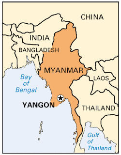
Unlike other politically isolated nations, there is a surprising about of freedom with regard to conversing with the locals of Myanmar (Burma), many of whom speak good English and are happy to talk about the problems facing the country. This makes Myanmar a fascinating place to visit. The traffic in Myanmar's former capital city of Yangon (Rangoon) has an interesting feature. There are no two-wheeled vehicles of any kind other than police vehicles, which is unique for a populous South-East Asian city.

Suppose 500 soldiers go into battle and 5 are fatally wounded. That's 5 fatalities, with a fatality rate of 1 fatality per 100 soldiers. The total number of soldiers is a measure of exposure: 500 soldiers are exposed to risk. If the battle is smaller, with only 200 soldiers, but at the same level of risk, we might expect only 2 fatalities. So reducing exposure reduces fatalities. If the battle is less intense, but of the same size, then 500 soldiers would again go into battle but the risk (as measured by the fatality rate) would be smaller; perhaps 1 fatality per 250 soldiers, and the number of fatalities again reduces to 2.

Road fatalities work in the same way. There are only two ways to reduce the number of fatalities: you reduce the risk or reduce the exposure to that risk, and most traffic policies affect both to some degree. Increased driver training seeks to reduce risk, but may also deter people from obtaining a licence which reduces exposure. Exposure is typically measured using either the total number of registered vehicles, the total distance traveled by all registered vehicles (which unfortunately is often inaccurate), or the total number of licence holders. If the risk remains constant, a large increase in these will lead to an increase in road fatalities.

Reducing the number of road fatalities to zero is easy: ban all motor vehicles. This reduces exposure to zero. Reducing exposure is easy to do, but while it may reduce fatalities, it inevitably impinges on the freedom of the individual. There is a trade-off, and so policies that reduce exposure are applied to circumstances where the risk is deemed to be high, such as with night-time curfews for young drivers and the setting of minimum driving ages. The policy in Yangon is an example of this approach. Even the safest motorcyclist acknowledges the increased risk that is present compared to driving a car. Yangon has reduced the exposure to zero for motorbikes which, relatively speaking, are a high-risk vehicle.

MUARC (Monash University Accident Research Centre) is perhaps the highest profile research group for road safety in Victoria. They have a publicly available series of reports. Some of these focus on cycling (here here here here) including a number on the use on bicycle helmets which I haven't included in the links. Other focus on motorcycling: on younger, older and high-risk riders (here here here), on crash information and countermeasures (here here here here), on training, licensing and hazard perception (here here here here).

Of particular interest is this report which reviewed motorcycle licensing and suggested an 'optimal model' for its implementation. The primary recommendation was that car licences should be a pre-requisite for bike licences (not implemented). Other recommendations included restrictions for L/P plate riders (zero alcohol, no pillion, power-to-weight) and an increase in the teaching of cognitive skills such as road-craft and hazard perception (all implemented to some degree). The reasoning behind these recommendations was clearly stated. Quoting from two sections of the report:

Another general principle of the optimal model is that, given the high crash risks associated with motorcycling, the model should not encourage increased exposure (...). For this reason, the total costs of obtaining a motorcycle licence (...) should not be cheaper than for a car licence.

The research suggests that any safety benefits of motorcycle licensing and training probably result more from exposure reduction (a reduction in the total amount of riding) than from crash risk reduction.


The aim of the proposed 'optimal model' is to contain exposure (i.e. to discourage the use of motorbikes) rather than to reduce risk. Surely then, it is the policy of Yangon that is the true optimum. But is it a bad one: should bikes be banned? Or perhaps we should ask the opposite question: should the use of bikes be encouraged, even if the increasing exposure leads to additional fatalities? What do you think?

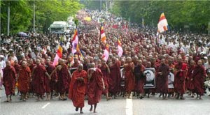
I think motorcycling should be made freely available to all those who desire it. The freedom of the individual to take his or her own risk is a right that should not be taken away by the state in the pursuit of lowering the road toll. In Melbourne, banning motorbikes would rightly lead to protests. In Yangon protests are met with force, and as demonstrated in 2007, dead protesters are soon forgotten. Yangon is not an example that should be followed.

Tuesday, April 27, 2010

The iPod Nano Bike Camera


I bought the new fifth generation iPod nano last month. My old Creative player and my current mobile phone are black-and-white displays; I don't update my gadgets very often. I was impressed. The main development of the fifth generation nano is the video camera. I had been looking for a bike video camera to video every second I'm on the motorbike while commuting and touring. The latest cameras from companies such as GoPro record in high definition. Technological advancement is focused on recording quality, while my focus is on battery life and storage capacity, and these often disappoint. The iPod nano was the solution.

I bought myself an iPod nano strap that joggers use for strapping their iPod to the upper arm. It also protects the iPod from the elements, as getting it wet is a bad idea. I attach it around the instrument cluster of the motorbike (top picture), and use some tape for additional waterproofing. It gives me sturdy mount that keeps the camera in place, and the iPod can easily be removed from the pocket on the strap. The strap can only be removed by disassembling the instrument cluster.

The video files are a little over 50 minutes for each 1GB. However the camera will automatically shut off when the file size reaches 2GB, at about 105 minutes. So at minimum you want 2GB of free space before starting the recording. The iPod comes in 8GB or 16GB versions; you can use either, but the 16GB is more suitable, as you don't have to keep deleting the 2GB video files before recording the next one. The 80 albums on my 16GB iPod take up about 6.4GB of space, so I have space remaining for 4 2GB video files before I need to start deleting older files. You can't delete parts of a file, so if you catch something that you want to keep, you'll have to keep the entire 2GB file until you reach a computer to upload it.

Battery life for video recording runs at slightly under two hours. If you record from a full charge, the camera will shut off at about 105 minutes, by which time your battery will be nearly empty. The good news is that the iPod can be recharged while it's recording. There are many battery extender solutions, both those made for the iPod and those made for any device with a USB cable. Some use AA or AAA batteries and others are charged by USB. I use a Duracell recharger which is charged by USB and has an on/off switch. I zip-tie the charger to the frame down-tube, with the iPod recharging cable connecting the iPod to the charger. When I start the video I also turn on the charger, which keeps the iPod fully charged as the charging rate is above what is needed for use. No more battery problems, and the iPod is ready for me to listen to some top-notch late nineties brit-pop once I reach my motel.

Using the iPod nano as a bike video camera is a surprising good solution. Video quality is 640x480 pixels at 30fps, which is good enough for my purposes (example six second video below, reduced to 320x240). The problem with portable video cameras for touring is always battery life, but the wide availability of battery extender solutions and the fact that you can recharge while recording means that you can get around this problem for the iPod. There are some disadvantages though. The auto 2GB shut off means stopping every 105 minutes to re-start the camera. Extensive use may lead to reduced battery performance over time. And you are taking the risk that the iPod will get wet and be ruined; while the jogging strap offers some protection, it is not waterproof. But overall, it works very well. It's worth a try if you already own one.


Monday, April 26, 2010

Day 3/3: The Prom


When you're on a bicycle or on foot, fellow hostel dwellers wish you a good trip. When you're on a motorbike, they wish you a safe trip. Having been wished a safe trip by a Scandinavian family, a friendly Irish lesbian couple, and a European of a non-identifiable nationality, I set off to complete the South Gippsland Highway. The South Gippsland Highway lies on the coastal plain South of the Strzelecki Ranges and finishes at Sale, where it connects with The Princes Highway.

Yarram, the only town of any size on the remote Eastern half of The South Gippsland Highway, was the first stop. Between Foster and Yarram, a side-road to Port Welshpool gives a view of the Southern coastline. It also has a small museum (top picture). At Yarram I accidentally filled up with premium fuel and was having breakfast at the bakery when a group of fifteen or so motorbikes parked next to my machine. Large bikes with lots of gadgets and hard lockable luggage; my GS500 with its soft panniers felt inferior.

About 20kms before Sale, around Longford, there are two turnoffs: the first goes to Seaspray while the second goes to Loch Sport, and I took the latter. The 50km road to Loch Sport runs along the strip of land surrounded by Lake Reeve and Lake Victoria, behind ninety-mile beach. It's a picturesque place to visit, but the pay-off didn't quite justify the 100km detour. Just outside of Loch Sport I had to slow down to avoid a group of large birds, Emus I think, running across the road. Unfortunately I was riding into the sun and they were a fair distance ahead of me, so my video camera (i.e. my iPod nano) didn't pick-up a usable image. Past Loch Sport, I tackled 9kms of compacted but rutted dirt within The Lakes National Park; a record for me as I rarely take the bike off the asphalt. I was happy to keep to the 30km/h speed limit.

After visiting the historic swing bridge just South of Sale (bottom picture), I finally completed The South Gippsland Highway. The bridge no longer swings (it is currently under repair), and no vehicles are allowed on it other than bicycles. Now through the back-roads above The Princes Highway; North to Maffra, then West through Heyfield, Toongabbie, Glengarry, Yallourn North and re-connecting with The Princes Highway at Moe. I must get myself a 'my bike is parked because I am watering a tree and I am perfectly fine' sign.

A trip North to Walhalla would have been a good ride but I wanted to get back early to avoid the returning long weekend traffic. So I took the slab back to Melbourne, with a rare trip on Eastlink to make the journey a little easier and a little dearer.

Riding Distance: 510 kms
Total Distance: 165 + 170 + 510 = 845 kms

Sunday, April 25, 2010

Day 2/3: The Prom


A 10am start and I headed out on an indirect route to The Prom via the junction just before Meeniyan to ride the whole of Meeniyan Promontory Road (C444), which passes through the small towns of Fish Creek and Yanakie. The roads were still drying from heavy rain overnight. Yanakie is literally just a general store ($6 for a coffee and bacon roll if you've missed breakfast) and a petrol station (no petrol in The Prom now, so fill up here).

On from Yanakie to The Prom entrance ($2.70 for bikes), and then down to Tidal River, the main centre for activities in The Prom. The C444 up to the entrance consists mainly of straight isolated roads. Once past the entrance, the C444 becomes a superb tree-lined biking road; but the trees hold an abundance of wildlife, so I relaxed and enjoyed the most awe-inspiring scenery that Victoria has to offer. The peaks and bushland eventually give way to stunning coastal views. Tourists go to The Great Ocean Road, locals go to The Prom.

A change of clothes at Tidal River and I was off for a long walk, exploring the area around Tidal River and The Loo-Errn Track. A couple of hours exercise was enough for me, so I got in the long queue at the cafe, grabbed some lunch, and rode back while taking some of the side roads to beaches and scenic look-outs on the Western side of The Prom.

Alighting at Fish Creek for a quick look around, it began to rain heavily, so I had a coffee while it cleared. With the sun and the mercury dropping I went back to Foster, stopping to visit Foster Cemetery, established in 1872 in a pretty location just before the town centre. "Born Sleeping" read one of the plaques.

I was intending to tackle The Grand Ridge Road tomorrow, but some of it is dirt; with all the recent rain I'll leave it for another day. I'll complete the South Gippsland Highway instead.

Riding Distance: 170 kms